Upstream Mapping Efficiency: Choosing Between LiDAR and Photogrammetry
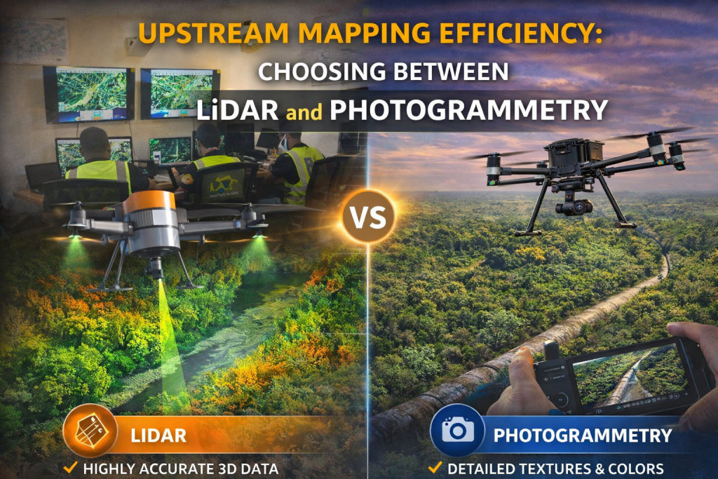
Upstream Mapping Efficiency is the cornerstone of successful geospatial data collection for modern oil and gas operations. In an era where precision dictates profitability, accurate data is no longer a luxury—it is a mandatory requirement for safety, planning, and environmental stewardship. From the initial survey of a pipeline corridor to the final inspection of a well pad, the quality of spatial data determines the success of the mission. Unmanned Aerial Vehicles (UAVs) have revolutionized this landscape, yet the most critical decision an operator faces remains the choice of sensor payload. To optimize workflows, one must navigate the distinct advantages of LiDAR and Photogrammetry.
Decoding the Power of Laser and Light in Upstream Mapping Efficiency
To make an informed strategic decision, it is essential to understand the mechanics of the technologies involved. LiDAR, or Light Detection and Ranging, is an active remote sensing technology. It functions by emitting thousands—often millions—of laser pulses per second and measuring the precise time it takes for each pulse to return to the sensor. This process creates a dense 3D point cloud of the environment. High-end systems like the DJI Zenmuse L2, when mounted on an enterprise platform such as the DJI Matrice 400 RTK, allow surveyors to capture ground elevations with incredible accuracy, even in environments where the terrain is physically obscured.
In contrast, photogrammetry is a passive mapping technique. It relies on capturing hundreds of overlapping, high-resolution RGB images, which are then processed through sophisticated algorithms. These systems, such as the Zenmuse P1, match common points across multiple photographs to reconstruct 3D models and high-detail orthomosaics. While LiDAR “measures” distance with lasers, photogrammetry “calculates” distance using visual geometry. Both are powerful, but their performance varies wildly depending on the physical environment of the project site.
Overcoming the Obstacle of Dense Vegetation
One of the most significant differentiators in upstream mapping is how a sensor handles ground cover. In many regions, pipeline routes must pass through forested or swampy environments where the ground is not visible from the air. This is where LiDAR truly excels. Because the laser pulses can find small gaps between leaves and branches, LiDAR can “penetrate” the canopy to reach the actual earth below. This capability allows for the creation of bare-earth models that are vital for hydrological studies and engineering design in complex terrains.
Photogrammetry, however, is limited to what the camera can see. If a dense canopy of trees covers the ground, the resulting 3D model will reflect the top of the trees rather than the soil. For projects where accurate ground elevation is required beneath a canopy, relying on photogrammetry often leads to inaccurate Digital Terrain Models (DTMs). Therefore, for right-of-way monitoring in wooded areas, LiDAR remains the industry’s gold standard for ensuring structural accuracy.
Precision Accuracy versus Visual Clarity
The choice between these payloads often comes down to a trade-off between geometric precision and visual detail. LiDAR provides superior vertical accuracy, making it the preferred choice for high-precision elevation modeling and complex topography. It captures the “skeleton” of the world with mathematical perfection. However, raw LiDAR data is often monochromatic and lacks the visual texture needed for detailed surface inspections. It tells you exactly where a pipe is, but it might not show you the specific color of the corrosion on that pipe.
Photogrammetry provides the visual context that LiDAR lacks. It produces high-resolution, photorealistic orthomosaics that are ideal for site documentation and visual asset monitoring. When an operator needs to see the exact state of a well pad’s construction or perform a visual audit of facility markings, the clarity provided by an RGB sensor is unmatched. For projects where visual analysis and budget-friendly surface documentation are the primary goals, photogrammetry offers a compelling and highly accessible solution.
Logistical Considerations: Speed, Cost, and Processing
Beyond the technical specs, operational reality plays a major role in payload selection. LiDAR systems are generally more complex and expensive, requiring advanced Inertial Measurement Units (IMUs) to maintain accuracy during flight. While the hardware investment is higher, LiDAR often requires less manual intervention during the data processing phase because the automated point cloud filtering can quickly distinguish between vegetation and the ground.
Photogrammetry setups are more affordable and easier to deploy, making them a popular choice for routine mapping tasks. However, the processing time for photogrammetry is heavily dependent on the number of images and the degree of overlap. In massive projects, the reconstruction of a high-resolution 3D model can be a computationally intensive task that takes significant time. Ultimately, if the project involves open terrain and a tighter budget, photogrammetry is often the logical choice. If the mission requires extreme accuracy in a challenging environment where “re-work” is not an option, the higher upfront cost of LiDAR is easily justified.
The Strategic Path: Integration and Hybrid Workflows
In the modern oil and gas sector, the most effective strategy is often not a choice between one or the other, but rather an integration of both. The technical edge in upstream operations is now found in hybrid workflows. Modern enterprise UAVs allow for the simultaneous capture of LiDAR point clouds and high-resolution RGB imagery. By combining these datasets, operators get the best of both worlds: the structural accuracy and terrain penetration of LiDAR coupled with the detailed visual textures of photogrammetry.
Choosing the right payload is a strategic decision driven by project objectives, terrain complexity, and budget constraints. Whether you are monitoring environmental impact in a floodplain or tracking the progress of a new well pad construction, understanding the operational environment is the key to success. By selecting the tool that matches the terrain, operators ensure reliable data, reduce the need for costly field revisits, and ultimately safeguard the integrity of their industrial assets.

